PROLOGUE
For many, the mention of Kansas conjures up phrases like The Wizard of Oz. and tornado alley. Kansas has its share of tornadoes - and much more. The deceptively flat plains can reveal awesome landscape as majestically as pulling a rabbit from a hat. It is a place where history modestly awaits the adventurer. Kansas hides its past from no one. It merely avoids the Interstate highways, allowing the unsuspecting traveler to pass by, oblivious.
The vast plains on either side of the Interstate might humble some, while others find them monotonous. Travelers might see nothing but endless miles of flat land. What they don’t see is out there – hidden in plain sight.
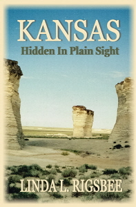
Valleys dot the vast plains like pockmarks from a forgotten childhood illness. Sandstone figures rise unexpectedly from the flat horizon like lethargic dinosaurs, their odd shaped heads changing perspective as if considering the traveler. Like a mirage, they fade back into the horizon.
From west to east, Kansas is full of history and mystery. What lies down that red ribbon of highway? During heavy rain periods, flooding may create bad road conditions, and in winter, ice, but generally speaking, Kansas roads are well maintained. The following pages offer a glimpse, but half of the fun is the process of discovery. So break the monotony of that long trip and venture off the beaten path.
Note from the author:
I have provided some maps, but always make sure to get a current map when you travel anywhere. We have had some pretty unpleasant experiences because we were using an outdated map.
I have provided telephone numbers and sometimes hours or days of operation as well as prices. Prices and hours generally change more quickly than telephone numbers. Make sure you get the most current information. I have included web sites for that purpose, but have found that at times even the websites are not current.
Usually, at rest stops they have flyers containing information about areas of interest. This book is not a complete listing of attractions. Sometimes, discovering on your own can be more rewarding.
The main purpose of this book is to assist travelers by providing places of interest to break the monotony of a long trip. However Kansas is a destination as much as a through route. Hot as a zesty pepper in the summer; cold as a rainbow slushy in the winter; it still has the ingredients for a tasteful vacation destination. Preparation is the key, and this book will help the traveler prepare.
Interstate 70 darts across the northern third of Kansas from the east in Kansas City to the Colorado border in the west. It strikes out across the flatlands, following the path of the least resistance. Interstate 70 at 70 mph is the fastest way to traverse Kansas from east to west or vice-verse, but fastest isn’t always best. Interstate highways are built for speed and convenience. I-70 links large cities and passes over or around flavorful rural towns. It dodges rough terrain, rolling through more than 200 miles of flat plains as if nothing else existed.
EAST-WEST ROUTES:
Interstate 70 spans Kansas in the north to north central region from Missouri on the east to Colorado on the west. It runs in long gradual curves from Kansas City to a few miles west of Kanorado on the Colorado border – a distance of well over 200 miles over the flattest terrain possible. It links Kansas City, and Topeka via the Kansas City Turnpike. A few familiar cities along this route are Lawrence, Junction City, Salina, Hays and Goodland. Those who have traveled this route and think they have seen Kansas have a big surprise coming. Minutes away from the interstate, hidden in the vast plains, are jaw-dropping arts of nature and breath-taking scenery. This book directs travelers to a few – enough to inspire spontaneous exploration.
US 36 in Northern Kansas:
From Elwood on the east side to 12 miles west of St. Francis, this route alternates between Agricultural and open range. It passes through the geographical center of the continental US. The tourist attractions are largely historical, but it also offers some scenic vistas, wildlife and unusual architecture.
US54/400 in South Central Kansas
Meandering from Opolis on the eastern border to a few miles west of Coolidge, this scenic route billboards the diversity of Kansas landscape. Familiar towns and cities along this route include the historic: Wichita, Dodge City and Garden City. It crosses some of the best known rivers in Kansas – the Neosho, Fall, Verdigris and Arkansas. Tourist attractions range from the second largest strip mining shovel in the world to the largest hand-dug well in the world. Texas, scoot over a little. Wildlife abounds, from prairie dogs and buffalo to deer, pheasant and wild turkey.
US 160 in southern Kansas:
This route hops, skips and jumps along the border of Kansas and Oklahoma from 6 miles east of Baxter Springs to about 15 miles west of Johnson City. Familiar towns include Independence and Medicine Lodge. This scenic route ranges from forested lowlands to high semi-arid plains. If you’ve never seen the Gypsum Hills, try to take this route sometime. Alternating between 160 and 166 paralleling to the south can provide some interesting changes as well.
NORTH-SOUTH ROUTES:
Kansas roads grid-line the state. For the most part, they run north-south or east-west. Interstate 35 is one of the exceptions. It enters Kansas from Oklahoma in the south as the Kansas Turnpike 4 miles south of Portland. South of Wichita it swings northeast to Topeka. However, I-135 continues north all the way to Salina. Here it joins US 81 and stays on a northerly route to the Nebraska border 13 miles north of Belleville. It is an excellent launching point for exploration. Even so, a few alternate routes offer equal surprises.
US69/7 in Eastern Kansas:
Highway US 69 teases the Oklahoma border at Baxter Springs. From there it follows an historic route all the way to Kansas City. Highway 7 marches north through more history all the way to the Nebraska border. Familiar cities on this duel route include Ft. Scott, Kansas City, Leavenworth and Atchison.
US 75 in Central Kansas:
Entering Kansas from Oklahoma by way of Caney, this highway makes only a few turns before it straightens out and heads north, all the way to the Nebraska, 11 miles north of Sabetha. Familiar cities on its route are Independence and Topeka. It skirts three large lakes and borders the Flint Hills. If gambling is your game, there are reservation casinos to occupy your spare time.
US 281 in Central Kansas:
Slicing the state in half, highway US 281 crosses the border from Oklahoma minutes before it reaches Hardtner. After a 6 mile right to the east, it bolts north to the Nebraska border 12 miles north of Lebanon – right through the geographical center of the Contiguous 48 states and within 15 miles of the geodetic center of North America. The scenery is ever-changing as it drifts from the Red Hills and open grasslands of the south through the Arkansas River lowlands and into the Smokey Hills. Great Bend, Medicine Lodge and Dodge City are among the familiar city names.
US 83 in Western Kansas:
Probably the most surprising highway is US 83, which enters Kansas from the panhandle of Oklahoma directly into Liberal. From there it cuts a straight path through agricultural fields until it slides east for a while. Eventually it heads north again to enter Nebraska 12 miles north of Oberlin. In this vast semi-arid plain are equally vast agricultural fields. In the morning hours, pheasants can often be seen. Keep on the lookout for Prairie Chickens and Pronghorn Antelope as well. Allow a little time for exploring, because this flat country has some breathtaking scenery and awesome surprises in hidden valleys.
This book surrounds Kansas and then works its way up and down these focal highways. How far travelers want to venture off the beaten path will depend on time allotment and individual interest. What they find and come away with depends on what they look for - Kansas is that diversified. Toss the preconceived ideas about Kansas out with those red slippers. This is Kansas, and its residents are proud of it.
ABOUT KANSAS
Kansas holds the distinction of being the geographical center of the continental United States. The exact point is in north central Kansas near the town of Lebanon. The state has a wide range of vegetation and climate. The lowest point is on the Verdigris River at 680 feet above sea level. The highest point is Mt. Sunflower at 4,039 feet above sea level. The terrain rises gradually from east to west, with the western plains being around 3000 feet above sea level. The largely rectangular state encompasses 82,264 square miles and roughly three million people – mostly in the large cities.
Kansas Territory was formed in 1854, but it didn’t become a state until January 29, 1861 – the 34th state in the Union. The state capital was, and still is, Topeka. However, the territorial capital was near Junction City.
Most people know about the burning of Lawrence in 1863 by Quantrell and his guerrilla band of raiders, but how many know it was the birthplace of what we now call “the west”? Called “bleeding Kansas” during the civil war, the term Jayhawkers was first used for the “Free State Men” – those against slavery.
From winter blizzards to sizzling summers; from the obsessions of Carrie Nation to the imagination of “The Wizard of Oz”; from the glitter of Kansas City to gentle waves of agriculture - Kansas is a contrast of extremes and a blend of cultures.
Names like the Flint Hills, the Cherokee Lowlands, and High plains section the land into geographical areas on many maps. This book explores the state by major highways into the tributaries of interesting byways. The western high plains are a good place to start, simply because they contain so many surprises. Often traveled but explored by so few, this is one of the must-see places in the west that rarely gets attention. Reputations are often based on first impressions or hearsay. This book is written from fact and experience.
Kansas highways are ever-changing, so always purchase a new map before exploring. Kansas road signs have a strange habit of teasing the traveler with interesting sites miles ahead – then letting them pass because nothing obvious marks that last turn. This friendly state can become tourist unfriendly without a current map. Take a snack and your favorite beverage because without them it can be seemingly endless miles between cities. Try not to let your gas tank get below half and use the restrooms when you can, not when you feel the need. Remember that peak tornado season is May through June, and that storms far away can cause flash flooding in low areas. By keeping all this in mind, the Sunflower State can be a treasure to explore.
NOTICE:
Effective January 1, 2020, only the prologue first chapter of this book will be available to read online FREE. Members may request free PDF copies.
Kansas, Hidden In Plain Sight
by Linda L. Rigsbee
Please sign the guest book and rate the story. Your comments are always welcome and your information is appreciated, but not required.


Non-Fiction - Travel